BASEMAP App // Fly Fishing GPS Tools
October 31, 2019
FREE Download
Upgrade to PRO - 10% OFF
We love to get off the beaten path and explore, and now we have a tool that has changed the game. Finding new fisheries, access points, and untouched water has never been easier. With the BASEMAP App you will know exactly where to park and begin your day before you even leave the house. Driving in a new city without Google Maps is like fishing without Basemap. Lots of wrong turns, wasted time, and you may even find yourself in the wrong part of town.
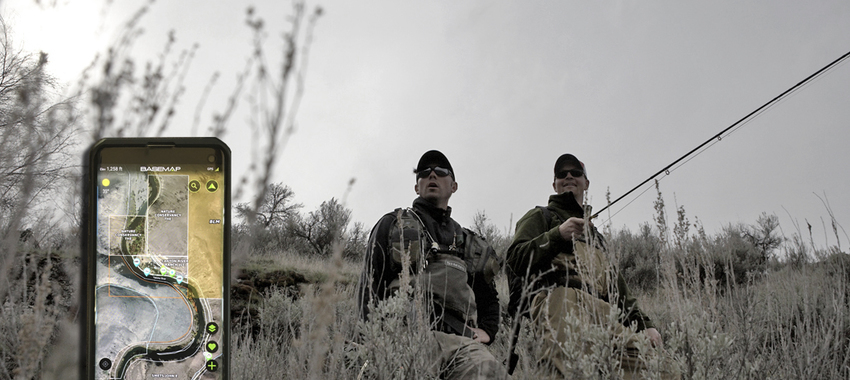
BASEMAP allows you to scout fisheries online from afar, and then turn your smartphone into a fully functional GPS with satellite imagery, downloadable off-grid maps, pre-set markers, private property boundaries, public access points, and connectivity to an entire outdoor community.
BASEMAP synchronizes with your desktop account to make it the #1 tool for creating a fishing plan and e-scouting new destinations. You can download the basic version for free, but we strongly encourage you to go PRO and take complete advantage of this tool. Our staff uses Basemap for all of our outdoor pursuits including fly fishing, hunting, hiking, skiing, mountain biking, etc. Adventure awaits!
-
Joe, this is not related to the GPS blog, wasn't sure where to contact you hope this works. I live in BC in Cranbrook and fish mostly freestone rivers and creeks primarily dry flies. I'm thinking of getting 10' 3wt for dry flies, high sticking, mending and skidering. So I'm using it like a 9' dry fly rod. What line wait would you recommend for this type of application?